Floodplain Remediation Plan
Meeting Details
The final Reading Flood Plain and Trails Plan Overview was presented to the Community and City Council and Administration on March 7 and March 8. To view the final flood plain presentation, please follow the link below.
Final Flood Plain Presentation
Overview
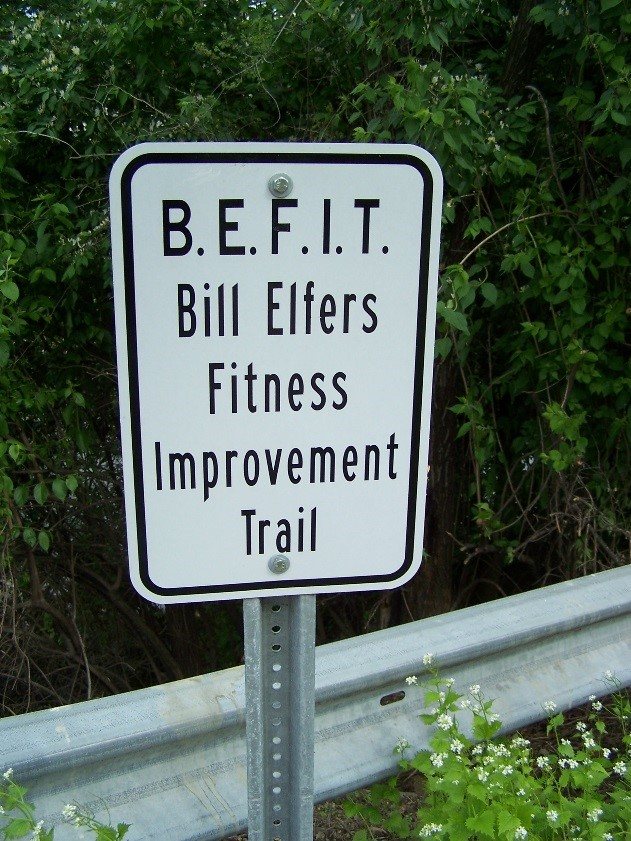
Momentum is also growing to form a regional network of bicycle and pedestrian trails, and the Mill Creek corridor has been identified by Tri-State Trails as an important regional trail corridor. Segments of the Mill Creek Greenway Trail have already been completed in the City of Cincinnati and more are planned.
The City of Reading, in partnership with the Mill Creek Watershed Council of Communities, has been awarded Community Development Block Grant funds to prepare a concept plan to address flood risk reduction and recreation trail opportunities in Reading’s Mill Creek Valley. The plan will identify opportunities for targeted improvements to address flood risk, while also identifying a preliminary corridor for the Mill Creek Greenway Trail through the area. Since these two issues are so closely linked, they are being considered together as part of the same planning effort. Your input and support will be key to making this plan successful. Please see below under “Community Engagement” for opportunities to contribute your knowledge to this important planning effort.
Background
In partnership with the Mill Creek Watershed Council of Communities, the City of Reading applied for and has received a grant to hire a consultant, AMEC Foster Wheeler, to conduct a coarse-level planning analysis that will address two issues:
- Recreation Trail Planning: The plan will identify the most feasible route for the Mill Creek Greenway Trail and opportunities for connecting trails within the City of Reading. The plan will also evaluate trail impacts to City parks and private properties.
- Flood Risk Reduction Opportunities: The plan will identify opportunities on City-owned properties and/or partnerships with local landowners with an eye toward improvements that could potentially reduce the base flood elevation in the area and remove some Reading residences and businesses from the 100-year floodplain.
Process and Schedule
- Inventory and Analysis (Complete): The project team will collect data such as land use patterns, existing infrastructure and utilities, and flood plain information.
- Identification of Challenges and Opportunities (Complete): A multidisciplinary team of landscape architects, planners, scientists, and engineers will review all the data and work through the constraints and problems and identify potential solutions.
- Public Input and Outreach (Ongoing): Two meetings were held on January 25, 2016 at the Reading Branch Library to present the team's initial findings and solicit ideas and feedback.
- Plan Preparation (Feb - Mar 2016): Based upon the data collected and the input received, AMEC Foster Wheeler will prepare a preliminary plan that outlines its recommendations to the City. The plan will identify the issues and opportunities, emphasizing how the proposed actions fit into the context of the region. The plan will assign priorities to these potential actions, identify ownership, potential teaming partners, implementation steps, define milestones, and outline potential funding sources.
- Plan Presentation (Apr 2016): The team will present the results of the plan at one final public meeting and obtain additional feedback. Copies of the report will be made available electronically to the attendees of the public meetings. The plan, once finalized, will become an important resource to guide the City's future decision-making on flood risk reduction and greenway trail planning issues.
Community Engagement
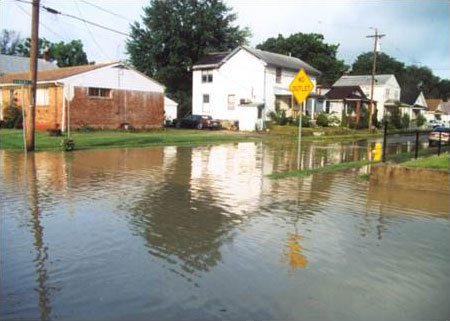
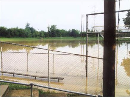
Key to success in this process is participation by the residents and businesses of Reading and we are seeking your input and support. Even if your house doesn’t flood, your children might play soccer or baseball on fields that do. Even if you don’t have to pay costly flood insurance, your property taxes and utility bills reflect this problem. While flooding may not have inconvenienced you, it has – directly or indirectly – affected the quality of your life and the value of your property. This is why we want your input, to learn what is important to you and how we can take advantage of a problem and make it a community solution.
Two meetings were held on January 25, 2016 at the Reading Branch Library to present the team’s initial findings and gather ideas and feedback. The following is a link to the Presentation
At each meeting there will be a Presentation that will include maps and descriptions of the problems and consideration of possible solutions. There will be discussions around how people are impacted and what solutions they would like to see. All comments received during these meetings will be captured and considered in the planning process.
Partners
This planning effort is made possible through a partnership of the following organizations:
- City of Reading - Project Owner and Grant Recipient
- Hamilton County Planning and Development - Administrator of CDBG Funds
- Mill Creek Watershed Council of Communities - Owner's Representative and Project Manager
- AMEC Foster Wheeler - Consultant
Mill Creek Watershed Council of Communities Regional Watershed Assistance Center
The City of Reading has partnered with the Mill Creek Watershed Council of Communities in the capacity as the state's first Regional Watershed Assistance Center (RWAC). The RWAC acts as a centralized resource for communities in the watershed, providing technical expertise, project management support, and community engagement to help communities become better watershed stewards.
Contact Us
Questions can be directed to the Mill Creek Watershed Council of Communities at (513) 563-8800